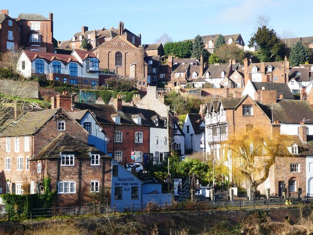
Bridgnorth - View of the town climbing the hill
Introduction
The photograph on this page of Bridgnorth - View of the town climbing the hill by Rob Farrow as part of the Geograph project.
The Geograph project started in 2005 with the aim of publishing, organising and preserving representative images for every square kilometre of Great Britain, Ireland and the Isle of Man.
There are currently over 7.5m images from over 14,400 individuals and you can help contribute to the project by visiting https://www.geograph.org.uk

Image: © Rob Farrow Taken: 30 Jan 2022
The town of Bridgnorth spans the River Severn and climbs quite steeply on the western side. The town is effectively in three parts, although they all merge - these are: The eastern section (to the east of the river), Low Town along the western riverside and High Town some 100+ feet higher up the slope. This view is looking across from the eastern side to the western side as it climbs from Low Town to High Town, with a fascinating jumble of buildings. Image] can be seen slightly right of centre. The wall at the bottom of the image is the man-made river bank along Riverside.

