St Margaret's at Cliffe buildings [3]
Introduction
The photograph on this page of St Margaret's at Cliffe buildings [3] by Michael Dibb as part of the Geograph project.
The Geograph project started in 2005 with the aim of publishing, organising and preserving representative images for every square kilometre of Great Britain, Ireland and the Isle of Man.

There are currently over 7.5m images from over 14,400 individuals and you can help contribute to the project by visiting https://www.geograph.org.uk
St Margaret's at Cliffe buildings [3]
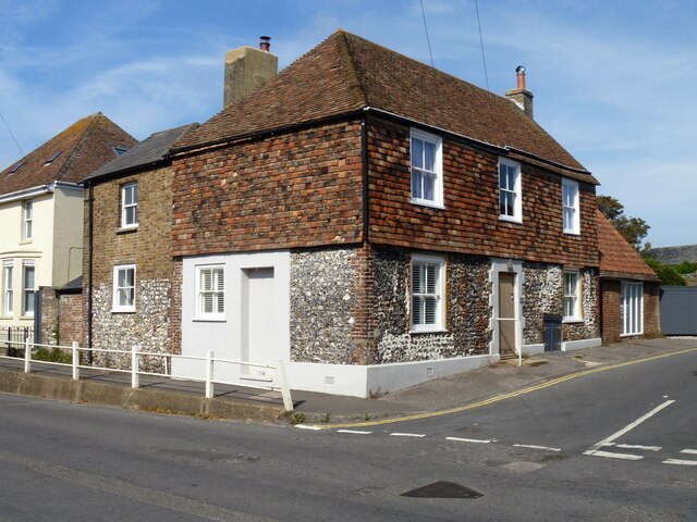
Image: © Michael Dibb Taken: 12 Sep 2021
The former Red Lion public house which closed circa 2015. Constructed circa 1825 replacing an earlier building. Built of flint with red brick dressings and tile hung with a tile roof, extended with white brick under a slate roof. Listed, grade II, with details at: https://historicengland.org.uk/listing/the-list/list-entry/1070068 St Margaret’s at Cliffe is a coastal village some 3 miles northeast of Dover. The village is the place in Britain that is nearest to the coast of France, 18 miles distant. The area has been settled since Anglo-Saxon times, and the village became a high class resort in the nineteenth century. The area has always been at the front line of cross Channel conflicts.
Images are licensed for reuse under creativecommons.org/licenses/by-sa/2.0
Image Location
Latitude
51.154925
Longitude
1.370763