Upper (East) Lighthouse and cottages, Nash Point, St Donats
Introduction
The photograph on this page of Upper (East) Lighthouse and cottages, Nash Point, St Donats by Colin Cheesman as part of the Geograph project.
The Geograph project started in 2005 with the aim of publishing, organising and preserving representative images for every square kilometre of Great Britain, Ireland and the Isle of Man.

There are currently over 7.5m images from over 14,400 individuals and you can help contribute to the project by visiting https://www.geograph.org.uk
Upper (East) Lighthouse and cottages, Nash Point, St Donats
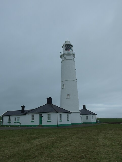
Image: © Colin Cheesman Taken: 1 Feb 2022
This is the upper of the two lighthouses built by Thomas Prothero in 1830 to assist navigation of the Bristol Channel. The eastern lighthouse represents the original high light, and continued in use after the closure of the low light in c. 1924. Its lantern was replaced in 1867, the lens was replaced in 1924. It was electrified in 1971. The lighthouse is listed as Grade II by Cadw.
Images are licensed for reuse under creativecommons.org/licenses/by-sa/2.0
Image Location
Latitude
51.400829
Longitude
-3.552203