
Churchill & Blakedown Signal Box
Introduction
The photograph on this page of Churchill & Blakedown Signal Box by Stephen McKay as part of the Geograph project.
The Geograph project started in 2005 with the aim of publishing, organising and preserving representative images for every square kilometre of Great Britain, Ireland and the Isle of Man.

There are currently over 7.5m images from over 14,400 individuals and you can help contribute to the project by visiting https://www.geograph.org.uk
Churchill & Blakedown Signal Box
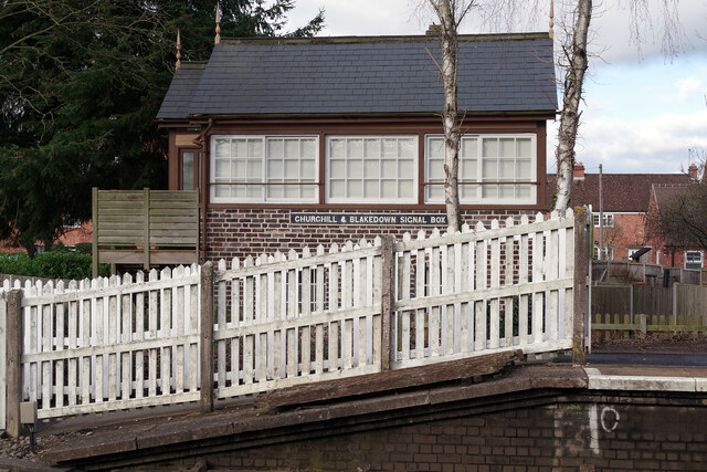
Image: © Stephen McKay Taken: 27 Jan 2022
Despite its proximity to Blakedown station this 1888 signal box is no longer part of the operational railway and is not even in its original position. Until its closure in 2012 as part of a resignalling scheme, it was located on the other side of the level crossing; see Image Network Rail offered the building for free to Churchill & Blakedown Parish Council, but there was a catch: the box was too close to the running lines and would have to be removed to a safer location. Once this had been achieved, it was given a new staircase and made disabled compliant; it is now used by the Blakedown Historical Society. Incidentally, although the station's name was shortened to simply 'Blakedown' in 1968 (it is actually located in Blakedown), the name of the signal box was never changed. See https://candbhistorical.weebly.com/about-the-box.html for some photographs of the demolition and reconstruction process.
Images are licensed for reuse under creativecommons.org/licenses/by-sa/2.0
Image Location

Latitude
52.406264
Longitude
-2.177379