Trig point, Berry Down
Introduction
The photograph on this page of Trig point, Berry Down by Derek Harper as part of the Geograph project.
The Geograph project started in 2005 with the aim of publishing, organising and preserving representative images for every square kilometre of Great Britain, Ireland and the Isle of Man.

There are currently over 7.5m images from over 14,400 individuals and you can help contribute to the project by visiting https://www.geograph.org.uk
Trig point, Berry Down
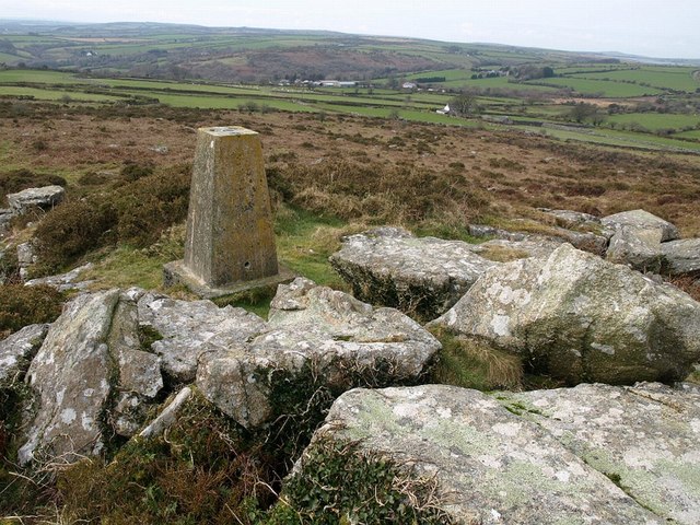
Image: © Derek Harper Taken: 28 Feb 2008
The triangulation pillar is at 282 metres, although the rocks nearby rise a little higher. This little tor is just northwest of Berry Castle, an extensive earthwork on Berry Down. The nearest cottage in the background is on the lane between Wenmouth Cross and Colliford Lake, and beyond that, in SX1869, is the valley of the St Neot River which drains the lake, which can just be glimpsed in the top right.
Images are licensed for reuse under creativecommons.org/licenses/by-sa/2.0
Image Location


Leaflet Map data © OpenStreetMap
Latitude
50.493337
Longitude
-4.543911