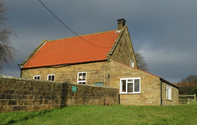
Friends Meeting House Osmotherley
Introduction
The photograph on this page of Friends Meeting House Osmotherley by Gordon Hatton as part of the Geograph project.
The Geograph project started in 2005 with the aim of publishing, organising and preserving representative images for every square kilometre of Great Britain, Ireland and the Isle of Man.
There are currently over 7.5m images from over 14,400 individuals and you can help contribute to the project by visiting https://www.geograph.org.uk

Image: © Gordon Hatton Taken: 27 Jan 2022
This appears to be the first time that the Friends Meeting House [Quakers] has been photographed for Geograph despite there being 165 other images in this square at the time of writing. The building does take some finding as it isn't signed from West End and is perched on the hillside just above what looks like a motor repair shop. The building is grade 2 listed and the listing states that it had been erected by 1733, which is odd as the date on the door lintel is 1723. The lean to extension is much newer and could date from 1947.

