
Quaker burial ground Lambston
Introduction
The photograph on this page of Quaker burial ground Lambston by Natasha Ceridwen de Chroustchoff as part of the Geograph project.
The Geograph project started in 2005 with the aim of publishing, organising and preserving representative images for every square kilometre of Great Britain, Ireland and the Isle of Man.

There are currently over 7.5m images from over 14,400 individuals and you can help contribute to the project by visiting https://www.geograph.org.uk
Quaker burial ground Lambston
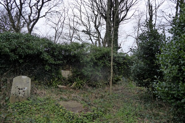
Image: © Natasha Ceridwen de Chroustchoff Taken: 22 Jan 2022
Within the inner enclosure of the double-walled burial ground only four grave markers are visible and they are in a poor state of repair. (Other burials may be unmarked.) The whole area is covered with ivy, brambles, ferns and other undergrowth making it impossible to investigate. The state of the place may reflect a lack of maintenance during the Covid pandemic. It's isolated amid fields some distance from Lambston village. Details about the graves and more information can be found here https://lambstonparish.wales/quaker-burial-ground/
Images are licensed for reuse under creativecommons.org/licenses/by-sa/2.0
Image Location

Latitude
51.808127
Longitude
-5.023387