Sutton Valence buildings [8]
Introduction
The photograph on this page of Sutton Valence buildings [8] by Michael Dibb as part of the Geograph project.
The Geograph project started in 2005 with the aim of publishing, organising and preserving representative images for every square kilometre of Great Britain, Ireland and the Isle of Man.

There are currently over 7.5m images from over 14,400 individuals and you can help contribute to the project by visiting https://www.geograph.org.uk
Sutton Valence buildings [8]
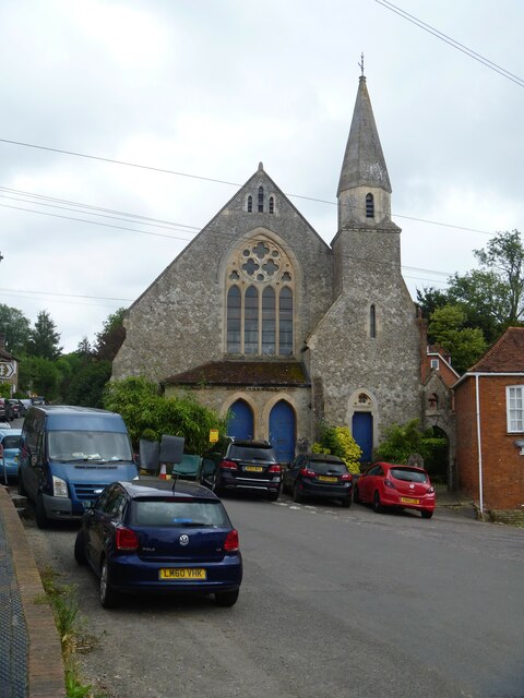
Image: © Michael Dibb Taken: 11 Sep 2021
Now known as Gulland Hall and housing Sutton Valence School's art department, this former Congregational Chapel was built in 1872. The village had had a non-conformist presence since the late 18th century. Constructed of rubble stone with ashlar dressings under a tile roof. Sutton Valence is a village 5¼ miles southeast of Maidstone and about 13 miles northwest of Ashford. The area was settled in the Iron Age and a Roman road passes through. Known as Sutton until the manor became the property of William de Valence, The village is home to a castle, now ruinous, built in the late 12th century and one of the oldest schools in England, founded in 1576 as a Free Grammar School.
Images are licensed for reuse under creativecommons.org/licenses/by-sa/2.0
Image Location
Latitude
51.213352
Longitude
0.596542