Madeley Junction
Introduction
The photograph on this page of Madeley Junction by Richard Law as part of the Geograph project.
The Geograph project started in 2005 with the aim of publishing, organising and preserving representative images for every square kilometre of Great Britain, Ireland and the Isle of Man.

There are currently over 7.5m images from over 14,400 individuals and you can help contribute to the project by visiting https://www.geograph.org.uk
Madeley Junction
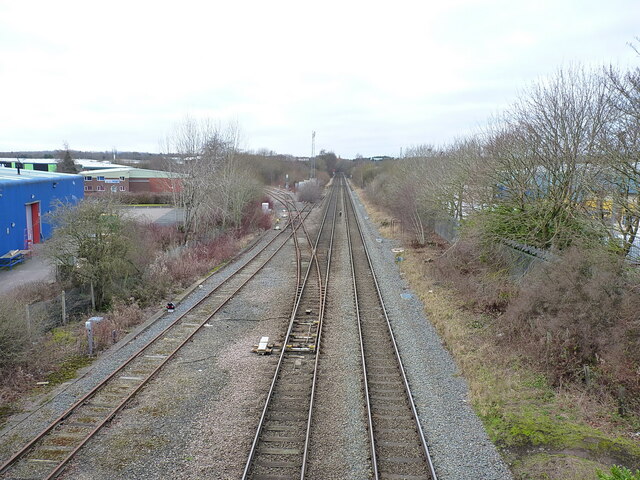
Image: © Richard Law Taken: 22 Jan 2022
The railway line heading off to the left is the former Madeley Branch line of the GWR, which originally connected into the (long-removed) line along the Severn valley between Bridgnorth and Shrewsbury. Until fairly recently, it was used for coal supplies to the Ironbridge power station, but that has now been decommissioned and demolished, the site being earmarked for a large housing development; there are hopes that the railway will be kept in place to provide an alternative means of transport for the residents of that new village. We shall see...
Images are licensed for reuse under creativecommons.org/licenses/by-sa/2.0
Image Location
Latitude
52.673293
Longitude
-2.416268