Lumps and bumps at Totternhoe Knolls
Introduction
The photograph on this page of Lumps and bumps at Totternhoe Knolls by Jeremy Bolwell as part of the Geograph project.
The Geograph project started in 2005 with the aim of publishing, organising and preserving representative images for every square kilometre of Great Britain, Ireland and the Isle of Man.

There are currently over 7.5m images from over 14,400 individuals and you can help contribute to the project by visiting https://www.geograph.org.uk
Lumps and bumps at Totternhoe Knolls
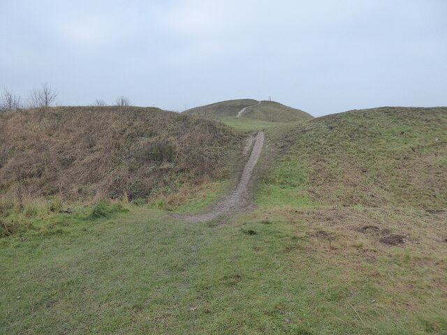
Image: © Jeremy Bolwell Taken: 15 Jan 2022
The lumps and bumps here are what seems to be a prehistoric hillfort, probably Iron Age in date, having been later used for a Norman or early medieval motte and baily castle site, taking over the already eminently defensible site perfectly suited to 'seeing and being seen' and used to control and subjugate the area. Here a hillfort ditch is also a bailey earthwork defence, now a ditch and a very popular location for local dog walkers, walkers and runners etc.
Images are licensed for reuse under creativecommons.org/licenses/by-sa/2.0
Image Location
Latitude
51.888506
Longitude
-0.578591