Overflow channel
Introduction
The photograph on this page of Overflow channel by Richard Sutcliffe as part of the Geograph project.
The Geograph project started in 2005 with the aim of publishing, organising and preserving representative images for every square kilometre of Great Britain, Ireland and the Isle of Man.

There are currently over 7.5m images from over 14,400 individuals and you can help contribute to the project by visiting https://www.geograph.org.uk
Overflow channel
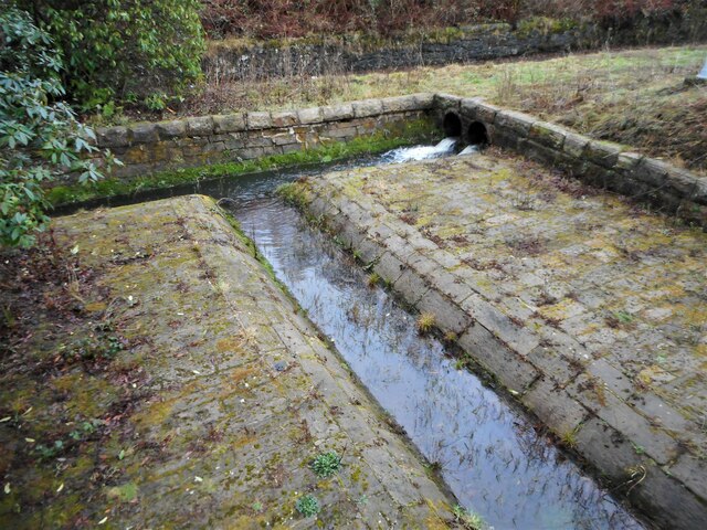
Image: © Richard Sutcliffe Taken: 11 Jan 2022
Water from Mugdock Reservoir (behind the photographer) can be released down this channel by a sluice below a footbridge Image It joins water already flowing down the channel that has come from Mugdock Loch to the north; and will flow into Tannoch Loch to the south.
Images are licensed for reuse under creativecommons.org/licenses/by-sa/2.0
Image Location
Latitude
55.952695
Longitude
-4.316618