Bridge over overflow channel, Mugdock Reservoir
Introduction
The photograph on this page of Bridge over overflow channel, Mugdock Reservoir by Richard Sutcliffe as part of the Geograph project.
The Geograph project started in 2005 with the aim of publishing, organising and preserving representative images for every square kilometre of Great Britain, Ireland and the Isle of Man.

There are currently over 7.5m images from over 14,400 individuals and you can help contribute to the project by visiting https://www.geograph.org.uk
Bridge over overflow channel, Mugdock Reservoir
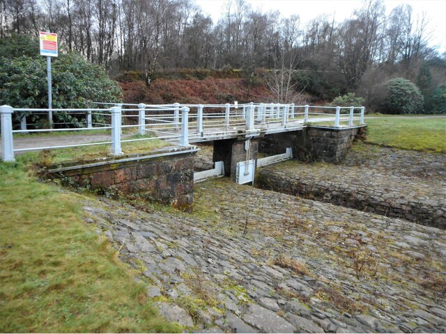
Image: © Richard Sutcliffe Taken: 11 Jan 2022
The footbridge with cast-iron railings is over the overflow channel at the southwest corner of the reservoir. There is a sluice mechanism below to control water levels. See Canmore https://canmore.org.uk/site/292223/glasgow-corporation-water-works-mugdock-reservoir-overflow. The sides of the reservoir are paved with small stones, which are well seen here.
Images are licensed for reuse under creativecommons.org/licenses/by-sa/2.0
Image Location
Latitude
55.952784
Longitude
-4.316624