Old milestone
Introduction
The photograph on this page of Old milestone by Chris Minto as part of the Geograph project.
The Geograph project started in 2005 with the aim of publishing, organising and preserving representative images for every square kilometre of Great Britain, Ireland and the Isle of Man.

There are currently over 7.5m images from over 14,400 individuals and you can help contribute to the project by visiting https://www.geograph.org.uk
Old milestone
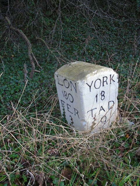
Image: © Chris Minto Taken: 9 Jan 2022
This old milestone near the brow of Betteras Hill is on Jeffrey's 1771 map. It is the only one still in situ from this era. It has a slightly squashed square shape set edge on to the road and was last painted in 2018. It is about 300m north of the West Riding CC milestone on the same side of the road. It is Grade II listed 1167565.
Images are licensed for reuse under creativecommons.org/licenses/by-sa/2.0
Image Location
Latitude
53.755751
Longitude
-1.252701