To Cannington's fallen
Introduction
The photograph on this page of To Cannington's fallen by Neil Owen as part of the Geograph project.
The Geograph project started in 2005 with the aim of publishing, organising and preserving representative images for every square kilometre of Great Britain, Ireland and the Isle of Man.

There are currently over 7.5m images from over 14,400 individuals and you can help contribute to the project by visiting https://www.geograph.org.uk
To Cannington's fallen
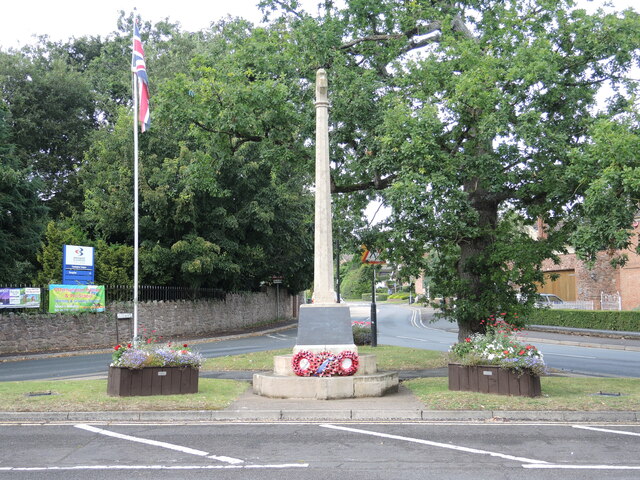
Image: © Neil Owen Taken: 19 Aug 2021
The war memorial stands on a traffic-encircled island at the end of Roadway. The Bridgwater and Taunton College site lies beyond the Henry Rogers almshouses. A committee was formed in early 1919 to create a memorial to the men who had not returned from foreign shores. Funds amounting to £274 10s 3d were raised; an architect was paid £5 5s 0d, and £252 2s 8d allotted to the memorial and its upkeep. A Mr Willis was paid £168 9s 0d to build the structure. Land owned by Philip Hales Pleydell-Bouverie of Brymore House was dedicated for the monument, which was unveiled on 11th November, 1921. However, more names had to be added after WWII and in 1957 the road had to be widened to allow heavy construction vehicles to work at the Hickley Point nuclear power station. The memorial is now about 2.5m west of its original point.
Images are licensed for reuse under creativecommons.org/licenses/by-sa/2.0
Image Location
Latitude
51.151263
Longitude
-3.063968