Winckworth Way bridge
Introduction
The photograph on this page of Winckworth Way bridge by Stephen Craven as part of the Geograph project.
The Geograph project started in 2005 with the aim of publishing, organising and preserving representative images for every square kilometre of Great Britain, Ireland and the Isle of Man.

There are currently over 7.5m images from over 14,400 individuals and you can help contribute to the project by visiting https://www.geograph.org.uk
Winckworth Way bridge
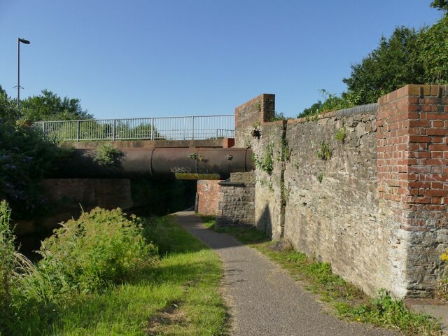
Image: © Stephen Craven Taken: 16 Jul 2021
The bridge carries Winckworth Way (which is pedestrianised south of this point) over the canal. There is a sewer pipe (helpfully named as such on old large-scale maps) that led to the town sewage works on the site of what is now the Priory Way industrial estate. The present sewage works is 5km further downriver at Image
Images are licensed for reuse under creativecommons.org/licenses/by-sa/2.0
Image Location
Latitude
51.022591
Longitude
-3.092102