Goodnestone buildings [12]
Introduction
The photograph on this page of Goodnestone buildings [12] by Michael Dibb as part of the Geograph project.
The Geograph project started in 2005 with the aim of publishing, organising and preserving representative images for every square kilometre of Great Britain, Ireland and the Isle of Man.

There are currently over 7.5m images from over 14,400 individuals and you can help contribute to the project by visiting https://www.geograph.org.uk
Goodnestone buildings [12]
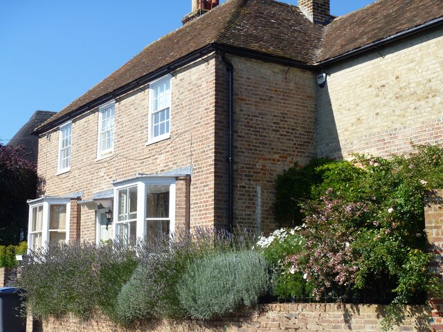
Image: © Michael Dibb Taken: 8 Sep 2021
Hazel Bank, The Street, was built in the 18th century and altered in the mid 19th century. Constructed of rose brick under a tile roof. Listed, grade II, with details at: https://historicengland.org.uk/listing/the-list/list-entry/1099202 Goodnestone is a village adjacent to the Goodnestone House and Gardens estate, some 7 miles southeast of Canterbury. Many of the village houses were built by the estate.
Images are licensed for reuse under creativecommons.org/licenses/by-sa/2.0
Image Location
Latitude
51.247567
Longitude
1.231836