Old Boundary Marker on Polly Barnes Hill, Bristol
Introduction
The photograph on this page of Old Boundary Marker on Polly Barnes Hill, Bristol by S Kosciow as part of the Geograph project.
The Geograph project started in 2005 with the aim of publishing, organising and preserving representative images for every square kilometre of Great Britain, Ireland and the Isle of Man.

There are currently over 7.5m images from over 14,400 individuals and you can help contribute to the project by visiting https://www.geograph.org.uk
Old Boundary Marker on Polly Barnes Hill, Bristol
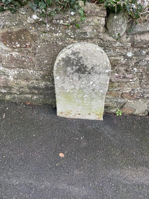
Image: © S Kosciow Taken: 3 Jan 2022
Municipal Boundary Marker against the garden wall of Brookside Cottage on the east side of Polly Barnes Hill. On the boundary of the City of Bristol and Hanham parish. Formerly Bristol St George and Kingswood parishes. Milestone Society National ID: GL_BRIHAN04pb
Images are licensed for reuse under creativecommons.org/licenses/by-sa/2.0
Image Location
Latitude
51.450051
Longitude
-2.522052