Looking up the line from Tenterden Town station
Introduction
The photograph on this page of Looking up the line from Tenterden Town station by Marathon as part of the Geograph project.
The Geograph project started in 2005 with the aim of publishing, organising and preserving representative images for every square kilometre of Great Britain, Ireland and the Isle of Man.

There are currently over 7.5m images from over 14,400 individuals and you can help contribute to the project by visiting https://www.geograph.org.uk
Looking up the line from Tenterden Town station
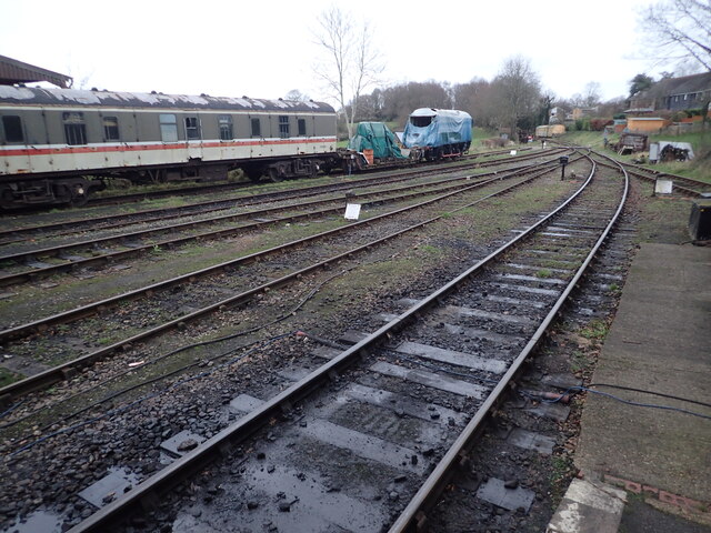
Image: © Marathon Taken: 3 Jan 2022
The original line of what is now the Kent & East Sussex Railway was opened by the Rother Valley Railway between Rolvenden and Robertsbridge in 1900. At that time Rolvenden station was named Tenterden until the station up the hill was opened. The railway extended to Tenterden Town in 1903 and on to Headcorn in 1905, naming itself the Kent & East Sussex Railway in the process. The section from Tenterden Town to Headcorn closed in 1954 and Tenterden itself closed with the line in 1961. Tenterdown Town station was reopened by the Kent & East Sussex Railway on 3rd February 1974 but the line only went as far as Rolvenden. The extension to Wittersham Road came in 1977, to Northiam in 1990 and to Bodiam in 2000. The signal box came from Chilham near Canterbury. On the original line, signal boxes were seen as an unnecessary luxury but the present line is signalled as a Southern Railway branch line which it never was. More information about the railway can be found at http://www.kesr.org.uk/ This view is from the end of the platform at Tenterden Town in the direction that the line would have originally run to Headcorn. The tracks end just around the bend in the distance.
Images are licensed for reuse under creativecommons.org/licenses/by-sa/2.0
Image Location
Latitude
51.071092
Longitude
0.686929