Birchington-on-Sea houses [1]
Introduction
The photograph on this page of Birchington-on-Sea houses [1] by Michael Dibb as part of the Geograph project.
The Geograph project started in 2005 with the aim of publishing, organising and preserving representative images for every square kilometre of Great Britain, Ireland and the Isle of Man.

There are currently over 7.5m images from over 14,400 individuals and you can help contribute to the project by visiting https://www.geograph.org.uk
Birchington-on-Sea houses [1]
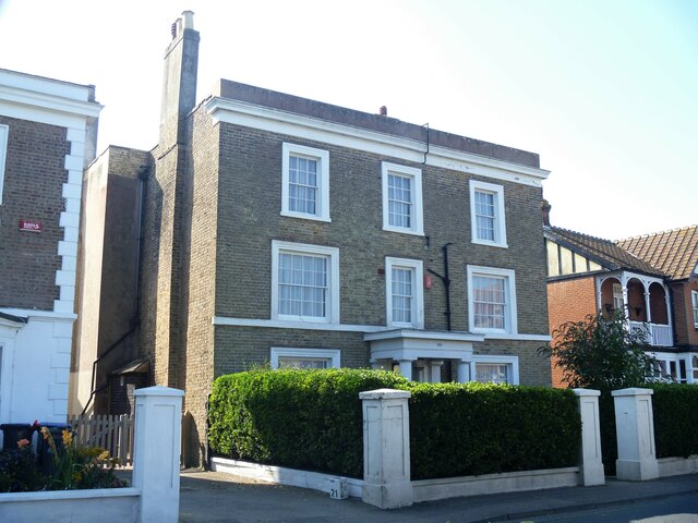
Image: © Michael Dibb Taken: 7 Sep 2021
Number 199 Canterbury Road was built in the mid 19th century. Constructed of brown brick with the roof hidden behind a parapet. There is a Doric portico. Listed, grade II, with details at: https://historicengland.org.uk/listing/the-list/list-entry/1341506 Birchington-on-Sea is a seaside village some 7 miles east of Herne Bay and some 3½ miles west of Margate. There is evidence of occupation from the Iron Age. As a resort, the village has a tourism based economy, with hotels, caravan parks and leisure attractions. Many retirees make the village their home.
Images are licensed for reuse under creativecommons.org/licenses/by-sa/2.0
Image Location
Latitude
51.37391
Longitude
1.30907