Botterham Lane near Wombourne in Staffordshire
Introduction
The photograph on this page of Botterham Lane near Wombourne in Staffordshire by Roger Kidd as part of the Geograph project.
The Geograph project started in 2005 with the aim of publishing, organising and preserving representative images for every square kilometre of Great Britain, Ireland and the Isle of Man.

There are currently over 7.5m images from over 14,400 individuals and you can help contribute to the project by visiting https://www.geograph.org.uk
Botterham Lane near Wombourne in Staffordshire
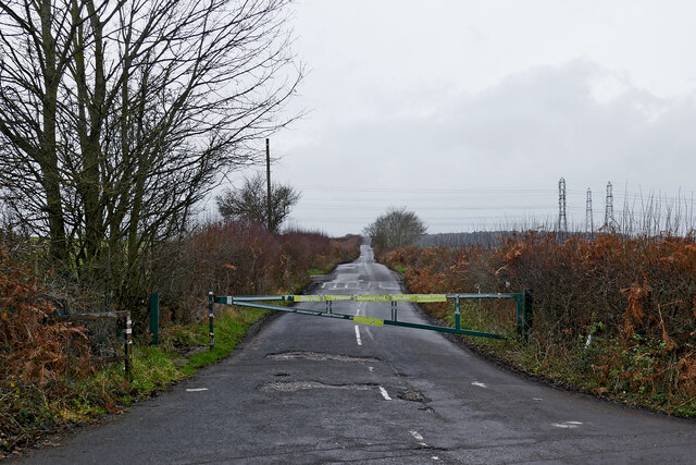
Image: © Roger Kidd Taken: 1 Jan 2022
New Year's Day. No entry!! Looking south-west from the junction with the B4176 Bridgnorth Road. The lane is a cul-de-sac and bridleway as far as Botterham Bridge on the Staffordshire and Worcestershire Canal. A public council recycling centre is situated on the left before the canal. I suppose the lane is gated and locked to discourage fly-tipping when the centre is closed. An hour later the gate was open and the padlock gone! There are no signs on the Bridgnorth Road indicating the presence of the Wombourne Recycling Centre. There is no sign at the junction to show that the lane is a dead end. There is no turning place to assist drivers of larger vehicles who make a mistake.
Images are licensed for reuse under creativecommons.org/licenses/by-sa/2.0
Image Location
Latitude
52.524089
Longitude
-2.198341