Ospringe houses [14]
Introduction
The photograph on this page of Ospringe houses [14] by Michael Dibb as part of the Geograph project.
The Geograph project started in 2005 with the aim of publishing, organising and preserving representative images for every square kilometre of Great Britain, Ireland and the Isle of Man.

There are currently over 7.5m images from over 14,400 individuals and you can help contribute to the project by visiting https://www.geograph.org.uk
Ospringe houses [14]
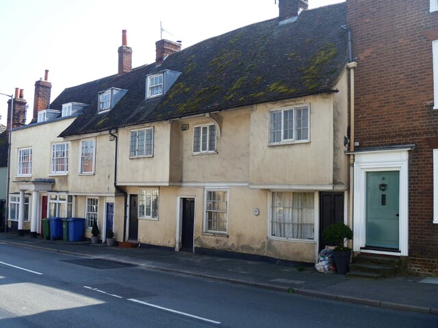
Image: © Michael Dibb Taken: 5 Sep 2021
Numbers 35, 37 and 39 Ospringe Street occupy one, probably, 15th century timber framed building with the two wings jettied to the street. The ground floor has been rebuilt in brick and the first floor stuccoed, all under a tile roof. Listed, grade II, with details at: https://historicengland.org.uk/listing/the-list/list-entry/1069432 Ospringe is a village and area of Faversham, Kent. The village lies on the Roman road Watling Street (now the A2). The historic Maison Dieu fronts onto Watling Street and the remains of substantial Roman buildings, thought to be the site of the Durolevum mentioned in the Antonine Itinerary, have been found nearby.
Images are licensed for reuse under creativecommons.org/licenses/by-sa/2.0
Image Location
Latitude
51.311599
Longitude
0.87264