
West Kirby Station ? 1971
Introduction
The photograph on this page of West Kirby Station ? 1971 by Alan Murray-Rust as part of the Geograph project.
The Geograph project started in 2005 with the aim of publishing, organising and preserving representative images for every square kilometre of Great Britain, Ireland and the Isle of Man.

There are currently over 7.5m images from over 14,400 individuals and you can help contribute to the project by visiting https://www.geograph.org.uk
West Kirby Station ? 1971
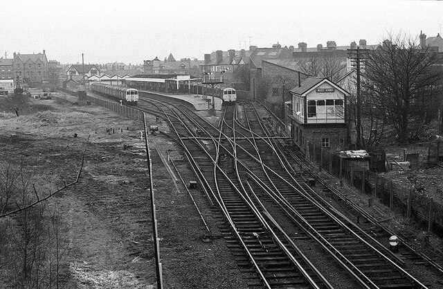
Image: © Alan Murray-Rust Taken: 6 Feb 1971
Remarkably, this excellent viewpoint of the station has not previously been used on Geograph. The station itself is much the same, but the signal box and the semaphore signals have gone, and the track layout is considerably simpler. On the left can be seen traces of the tracks which connected to the line via Neston to Hooton, which had a separate station off to the left which closed to passengers in 1956 and to freight in 1962. There were also goods yards (for both lines), now occupied by a fire station and a large public car park. The siding with a train standing on it has also been removed.
Images are licensed for reuse under creativecommons.org/licenses/by-sa/2.0
Image Location

Latitude
53.374156
Longitude
-3.184099