Railway bridge and canal in Nuneaton, Warwickshire
Introduction
The photograph on this page of Railway bridge and canal in Nuneaton, Warwickshire by Roger Kidd as part of the Geograph project.
The Geograph project started in 2005 with the aim of publishing, organising and preserving representative images for every square kilometre of Great Britain, Ireland and the Isle of Man.

There are currently over 7.5m images from over 14,400 individuals and you can help contribute to the project by visiting https://www.geograph.org.uk
Railway bridge and canal in Nuneaton, Warwickshire
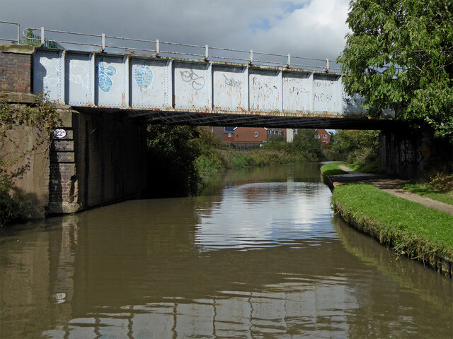
Image: © Roger Kidd Taken: 25 Sep 2016
Looking north as the canal meanders northwards towards Atherstone, this bridge has now been given the number 22A. The railway crossing the canal is the line to Birmingham (from Leicester and Peterborough). Since the Beeching Axe railway closures in the 1960s, it is the only direct railway link between the West Midlands and the East of England.
Images are licensed for reuse under creativecommons.org/licenses/by-sa/2.0
Image Location


Leaflet Map data © OpenStreetMap
Latitude
52.526292
Longitude
-1.487018