Stone Stile, Nympsfield
Introduction
The photograph on this page of Stone Stile, Nympsfield by Mr Red as part of the Geograph project.
The Geograph project started in 2005 with the aim of publishing, organising and preserving representative images for every square kilometre of Great Britain, Ireland and the Isle of Man.

There are currently over 7.5m images from over 14,400 individuals and you can help contribute to the project by visiting https://www.geograph.org.uk
Stone Stile, Nympsfield
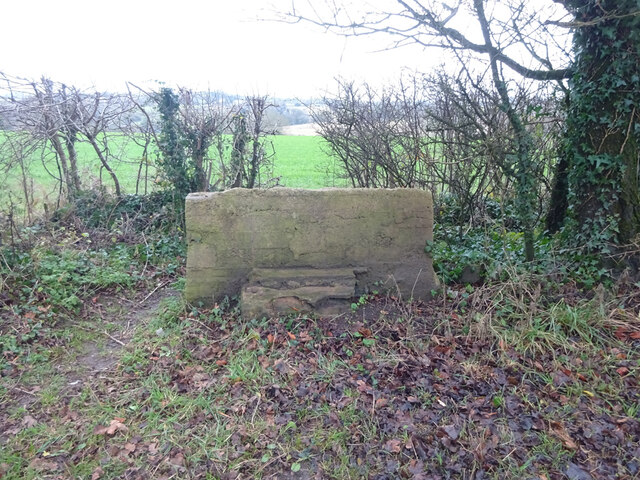
Image: © Mr Red Taken: 15 Dec 2021
This has been covered in concrete to stabilise the stile. There is enough stone at the base of the RH edge to suggest the original slab is in there, if in pieces. The view is looking South from Tinkley Lane. The view North is Image The presence of a Benchmark (lower left, representing 231.4 m ASL) would put the concreting before 1960. See photos: http://benchmarks.mister.red/#so80350082
Images are licensed for reuse under creativecommons.org/licenses/by-sa/2.0
Image Location
Latitude
51.705807
Longitude
-2.285532