Old Boundary Marker south of Widcombe Hill, Bath
Introduction
The photograph on this page of Old Boundary Marker south of Widcombe Hill, Bath by A Ward as part of the Geograph project.
The Geograph project started in 2005 with the aim of publishing, organising and preserving representative images for every square kilometre of Great Britain, Ireland and the Isle of Man.

There are currently over 7.5m images from over 14,400 individuals and you can help contribute to the project by visiting https://www.geograph.org.uk
Old Boundary Marker south of Widcombe Hill, Bath
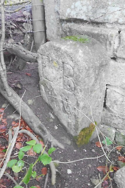
Image: © A Ward Taken: 28 Nov 2021
Boundary Marker where a stone wall meets a fence in the middle of a wood south of Widcombe Hill, a road. Not marked on OS maps until 1904. On the former boundary of Bathwick and Claverton parishes, from 1900 Bath and Claverton parishes, from 1951 entirely in Bath parish. The inscription E B / V W does not relate to any of these. Milestone Society National ID: SO_BATH05bm
Images are licensed for reuse under creativecommons.org/licenses/by-sa/2.0
Image Location
Latitude
51.373715
Longitude
-2.337334