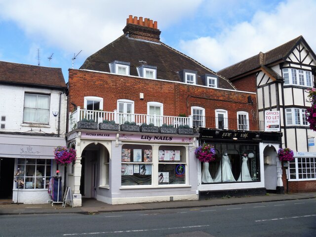
Datchet buildings [11]
Introduction
The photograph on this page of Datchet buildings [11] by Michael Dibb as part of the Geograph project.
The Geograph project started in 2005 with the aim of publishing, organising and preserving representative images for every square kilometre of Great Britain, Ireland and the Isle of Man.
There are currently over 7.5m images from over 14,400 individuals and you can help contribute to the project by visiting https://www.geograph.org.uk

Image: © Michael Dibb Taken: 19 Aug 2021
Numbers 6 and 8 High Street were built in the late 18th century, with many later alterations. Constructed of red brick under a tiled mansard roof. The shopfronts are early 20th century. Some original internal features remain. Listed, grade II, with details at: https://historicengland.org.uk/listing/the-list/list-entry/1117634 Datchet is a village on the north bank of the River Thames in the Royal Borough of Windsor and Maidenhead in Berkshire, about 1¼ miles east of Windsor. There is evidence of continuous occupation since the end of the last ice age. The village developed because of the ferry service which connected it to the main London Road across the River Thames. Now a pleasant commuter village with Waterloo station only 54 minutes away.

