The exit of the Beck Valley Storm Water Culvert
Introduction
The photograph on this page of The exit of the Beck Valley Storm Water Culvert by Alan Murray-Rust as part of the Geograph project.
The Geograph project started in 2005 with the aim of publishing, organising and preserving representative images for every square kilometre of Great Britain, Ireland and the Isle of Man.

There are currently over 7.5m images from over 14,400 individuals and you can help contribute to the project by visiting https://www.geograph.org.uk
The exit of the Beck Valley Storm Water Culvert
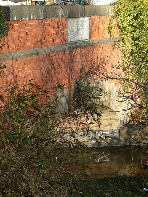
Image: © Alan Murray-Rust Taken: 10 Dec 2021
The culvert is a major construction built in the 1880s to cope with surface water from the rapid urbanisation of the east side of Nottingham. It originates with the 'Beck' which flowed from St Ann's Well roughly on the line of St Ann's Well Road, Huntingdon Street and Lower Parliament Street to join the original River Leen a short distance east of the present London Road. To cope with the estimated maximum flow, based even then on a maximum recorded 1.4 inches (3.5 cm) in a 30 minute period, the culvert is 6 ft (1.8 m) diameter in its upper reaches, increasing to an oval cross section of 13ft 6 in x 9 ft 8 in (4.1 x 2.95 m). Note the commemorative foundation stone facing out into the river, where it would be virtually unread. In practice this is double sided, with the same inscription on the inland face, seen here http://www.geograph.org.uk/photo/7041196
Images are licensed for reuse under creativecommons.org/licenses/by-sa/2.0
Image Location
Latitude
52.943078
Longitude
-1.122427