Grassington houses [5]
Introduction
The photograph on this page of Grassington houses [5] by Michael Dibb as part of the Geograph project.
The Geograph project started in 2005 with the aim of publishing, organising and preserving representative images for every square kilometre of Great Britain, Ireland and the Isle of Man.

There are currently over 7.5m images from over 14,400 individuals and you can help contribute to the project by visiting https://www.geograph.org.uk
Grassington houses [5]
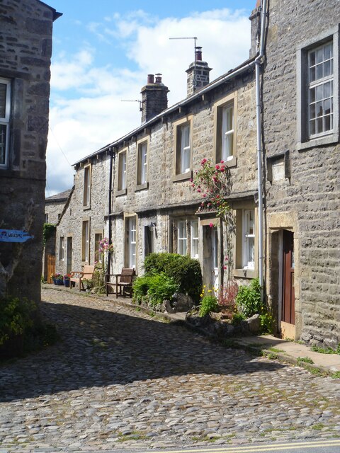
Image: © Michael Dibb Taken: 26 Jun 2021
Numbers 2, 4 and 6 Chamber End Fold were originally one house, now three. Dated 1685, divided and altered in the late 18th or early 19th century. Constructed of coursed gritstone rubble with freestone dressings under a stone slate roof. The 17th century house was possibly divided into separate cottages to satisfy the demand for accommodation for workers in the lead mines on Grassington Moor. Listed, grade II, with details at: https://historicengland.org.uk/listing/the-list/list-entry/1132143. Grassington is a small market town, receiving its charter in 1282. The town is located in Wharfedale in the Yorkshire Dales National Park, some 7½ miles north of Skipton. Lead mining brought prosperity to the town in the 18th and 19th centuries. The town now attracts many tourists, especially walkers, with some excellent routes on the surrounding fells.
Images are licensed for reuse under creativecommons.org/licenses/by-sa/2.0
Image Location
Latitude
54.073784
Longitude
-1.996602