Acton village centre
Introduction
The photograph on this page of Acton village centre by Espresso Addict as part of the Geograph project.
The Geograph project started in 2005 with the aim of publishing, organising and preserving representative images for every square kilometre of Great Britain, Ireland and the Isle of Man.

There are currently over 7.5m images from over 14,400 individuals and you can help contribute to the project by visiting https://www.geograph.org.uk
Acton village centre
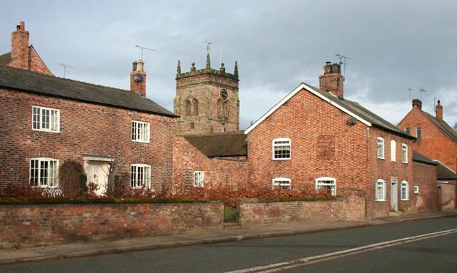
Image: © Espresso Addict Taken: 24 Feb 2008
Victorian houses in the centre of Acton village, with St Mary's Church behind. The buildings in the village to the west of the A534 (Chester Road; foreground) mainly date from the 17th-19th centuries, with the modern buildings all lying to the east of the road. The Monks Lane turn off is after the rightmost house
Images are licensed for reuse under creativecommons.org/licenses/by-sa/2.0
Image Location
Latitude
53.073136
Longitude
-2.550568