Rillington, High Street, 'top end'
Introduction
The photograph on this page of Rillington, High Street, 'top end' by Leanmeanmo as part of the Geograph project.
The Geograph project started in 2005 with the aim of publishing, organising and preserving representative images for every square kilometre of Great Britain, Ireland and the Isle of Man.

There are currently over 7.5m images from over 14,400 individuals and you can help contribute to the project by visiting https://www.geograph.org.uk
Rillington, High Street, 'top end'
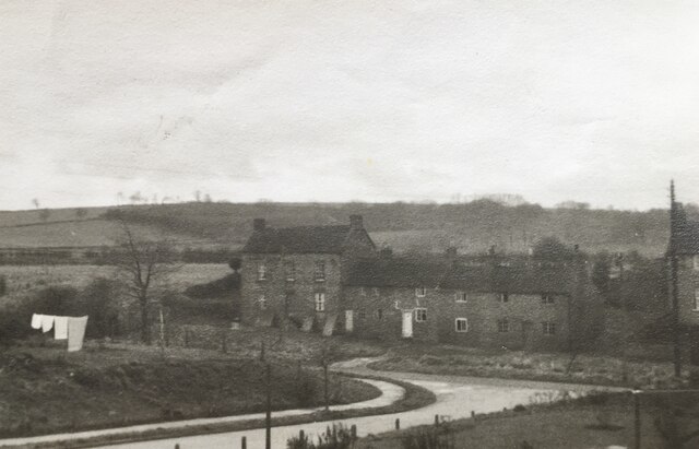
Image: © Leanmeanmo Taken: Unknown
Three triangular cement 'buttresses' can be seen supporting the lowest floor of the large house. The terrace was demolished in the late 60s / early 70s.
Images are licensed for reuse under creativecommons.org/licenses/by-sa/2.0
Image Location
Latitude
54.15616
Longitude
-0.693463