Pateley Bridge buildings [12]
Introduction
The photograph on this page of Pateley Bridge buildings [12] by Michael Dibb as part of the Geograph project.
The Geograph project started in 2005 with the aim of publishing, organising and preserving representative images for every square kilometre of Great Britain, Ireland and the Isle of Man.

There are currently over 7.5m images from over 14,400 individuals and you can help contribute to the project by visiting https://www.geograph.org.uk
Pateley Bridge buildings [12]
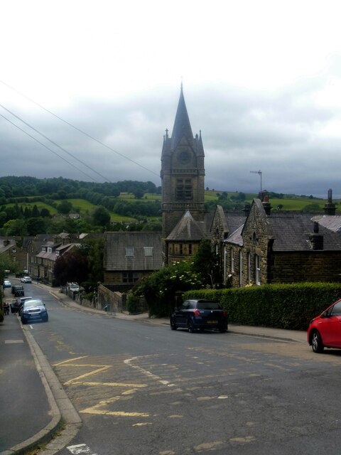
Image: © Michael Dibb Taken: 23 Jun 2021
A view along King Street, from Church Street. The tower is part of St Cuthbert's primary school. Pateley Bridge is a small market town, the market charter being granted in 1320. Located on the banks of the River Nidd, the town is some 11 miles northwest of Harrogate, some 10 miles southwest of Ripon and is within the Nidderdale Area of Outstanding Natural Beauty. The town is popular with tourists exploring the Yorkshire Dales.
Images are licensed for reuse under creativecommons.org/licenses/by-sa/2.0
Image Location


Leaflet Map data © OpenStreetMap
Latitude
54.087332
Longitude
-1.760108