Post Office Telegraphs cable joint marker
Introduction
The photograph on this page of Post Office Telegraphs cable joint marker by Derek Pattenson as part of the Geograph project.
The Geograph project started in 2005 with the aim of publishing, organising and preserving representative images for every square kilometre of Great Britain, Ireland and the Isle of Man.

There are currently over 7.5m images from over 14,400 individuals and you can help contribute to the project by visiting https://www.geograph.org.uk
Post Office Telegraphs cable joint marker
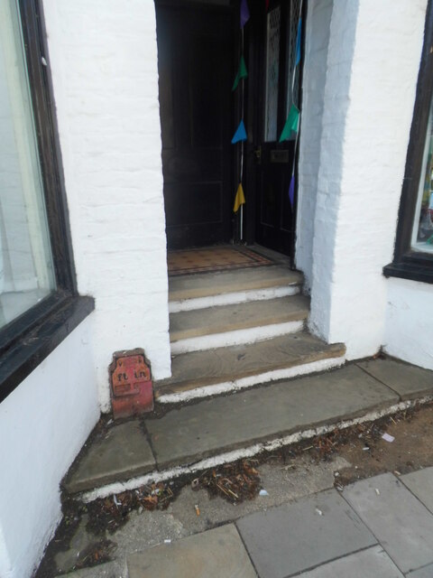
Image: © Derek Pattenson Taken: 23 Aug 2021
VR-era (1897-1901) telegraph cable joint marker, at 179 Watling Street, Towcester. The marker indicates the position of a joint in the buried telegraph cable. Originally numerals would indicate the distance in feet and inches directly in front of the marker. This one is unusual in being placed on private property. It's likely the steps were built around it. Less than half the post is visible above ground. The cable route is the original London-Birmingham route, the first long-distance underground telegraph route in the UK. A large number of these markers remain in Towcester, swapping sides of the A5 several times.
Images are licensed for reuse under creativecommons.org/licenses/by-sa/2.0
Image Location
Latitude
52.131997
Longitude
-0.988845