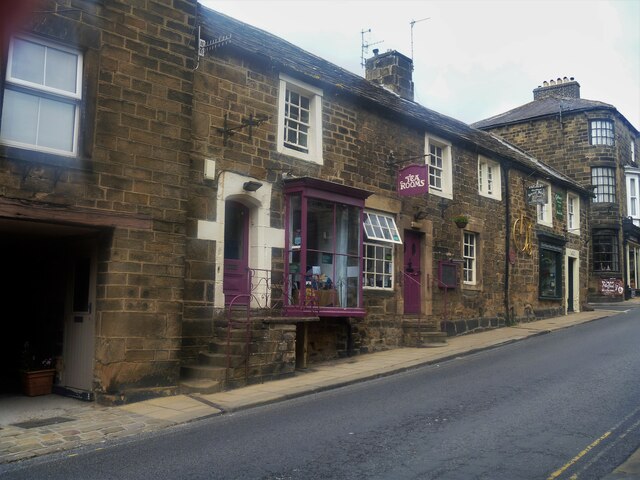
Pateley Bridge buildings [4]
Introduction
The photograph on this page of Pateley Bridge buildings [4] by Michael Dibb as part of the Geograph project.
The Geograph project started in 2005 with the aim of publishing, organising and preserving representative images for every square kilometre of Great Britain, Ireland and the Isle of Man.
There are currently over 7.5m images from over 14,400 individuals and you can help contribute to the project by visiting https://www.geograph.org.uk

Image: © Michael Dibb Taken: 23 Jun 2021
Originally one house, this is now three shops, numbers 35, 37 and 39 High Street. Built in the 17th century with alterations in the 18th century and later. Constructed of squared, coursed stone with freestone dressings, under a stone slate roof. The bay window on the left is 20th century, as is the shopfront on the right. Listed, grade II, with details at: https://historicengland.org.uk/listing/the-list/list-entry/1173812 Pateley Bridge is a small market town, the market charter being granted in 1320. Located on the banks of the River Nidd, the town is some 11 miles northwest of Harrogate, some 10 miles southwest of Ripon and is within the Nidderdale Area of Outstanding Natural Beauty. The town is popular with tourists exploring the Yorkshire Dales.

