Stone Stile, Sevenleaze Lane
Introduction
The photograph on this page of Stone Stile, Sevenleaze Lane by Mr Red as part of the Geograph project.
The Geograph project started in 2005 with the aim of publishing, organising and preserving representative images for every square kilometre of Great Britain, Ireland and the Isle of Man.

There are currently over 7.5m images from over 14,400 individuals and you can help contribute to the project by visiting https://www.geograph.org.uk
Stone Stile, Sevenleaze Lane
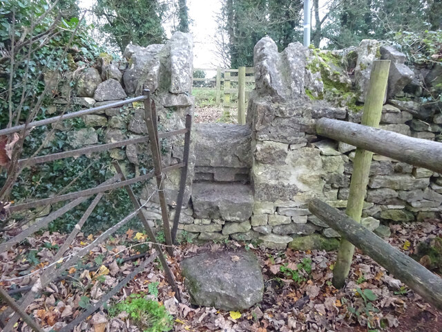
Image: © Mr Red Taken: 28 Nov 2021
View from the field. Rivet Benchmark on the other side. Road view see Image The Benchmark was last surveyed in 1966 so this footpath and stile has existed for longer, but it is not clear that the route a only a "permissive path", the original registered route (Gloucestershire footpath MPA13) is not useable now.
Images are licensed for reuse under creativecommons.org/licenses/by-sa/2.0
Image Location
Latitude
51.791187
Longitude
-2.222958