Old Boundary Marker by the Grove School, Malvern
Introduction
The photograph on this page of Old Boundary Marker by the Grove School, Malvern by J Scrine as part of the Geograph project.
The Geograph project started in 2005 with the aim of publishing, organising and preserving representative images for every square kilometre of Great Britain, Ireland and the Isle of Man.

There are currently over 7.5m images from over 14,400 individuals and you can help contribute to the project by visiting https://www.geograph.org.uk
Old Boundary Marker by the Grove School, Malvern
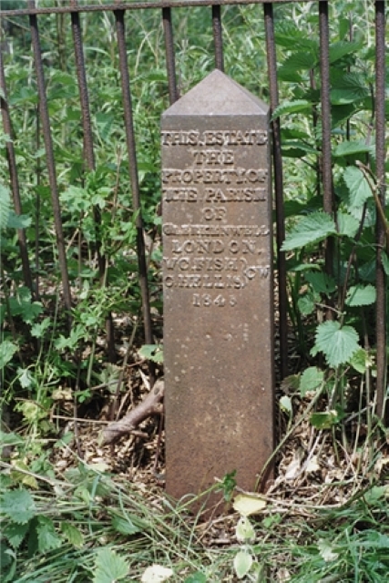
Image: © J Scrine Taken: 15 Feb 2011
Estate Boundary Marker by the railings of the Grove School. Malvern parish. Cockshute Farm Estate was acquired in 1658 by Sir George Strode and he donated the income to the parish church and poor hospital of St. James in Clerkenwell, London. The posts were erected in the mid-1800s to mark the boundary of the estate. 25 were shown on a map of 1884 and many survive in gardens as the estate has been developed for housing. Grade II Listed details https://historicengland.org.uk/listing/the-list/list-entry/1349464. Milestone Society National ID: WO_CLERK06em
Images are licensed for reuse under creativecommons.org/licenses/by-sa/2.0
Image Location
Latitude
52.120366
Longitude
-2.317226