Oxfam Stroud
Introduction
The photograph on this page of Oxfam Stroud by Jaggery as part of the Geograph project.
The Geograph project started in 2005 with the aim of publishing, organising and preserving representative images for every square kilometre of Great Britain, Ireland and the Isle of Man.

There are currently over 7.5m images from over 14,400 individuals and you can help contribute to the project by visiting https://www.geograph.org.uk
Oxfam Stroud
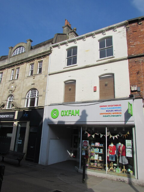
Image: © Jaggery Taken: 18 Apr 2021
Oxfam charity shop at 45 King Street. Text on the nameboard in April 2021 includes GROWS VEGETABLES FILLS CLASSROOMS BUILDS WELLS EMPOWERS WOMEN FIGHTS POVERTY Oxfam was founded in Oxford in 1942 as the Oxford Committee for Famine Relief by a group of Quakers, social activists and Oxford academics. It changed its name to Oxfam in 1965.
Images are licensed for reuse under creativecommons.org/licenses/by-sa/2.0
Image Location
Latitude
51.746017
Longitude
-2.217362