St Cuthbert's in Donington, near Albrighton
Introduction
The photograph on this page of St Cuthbert's in Donington, near Albrighton by Richard Law as part of the Geograph project.
The Geograph project started in 2005 with the aim of publishing, organising and preserving representative images for every square kilometre of Great Britain, Ireland and the Isle of Man.

There are currently over 7.5m images from over 14,400 individuals and you can help contribute to the project by visiting https://www.geograph.org.uk
St Cuthbert's in Donington, near Albrighton
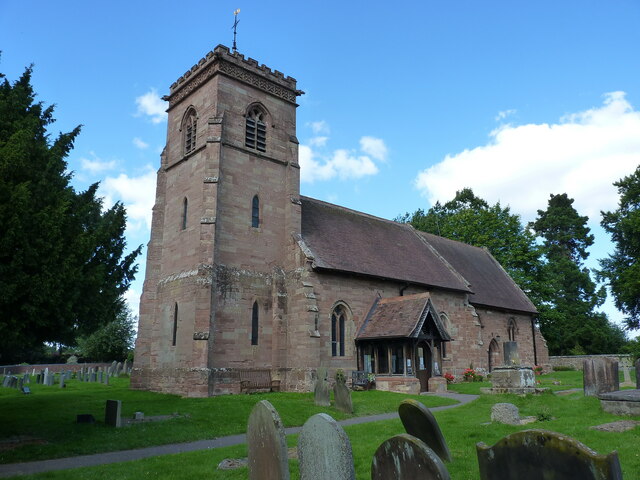
Image: © Richard Law Taken: 19 Jul 2020
The chancel of the church dates back to the early 14th century, and is probably therefore of similar age to the Image in the churchyard just outside the porch. The church has grown over the years, for instance with traces of 14th & 15th century stained glass and window architecture, and a probable 17th century hammerbeam roof structure, whilst the tower is a later addition. The whole building attracted a Grade II* listing https://britishlistedbuildings.co.uk/101273838-church-of-st-cuthbert-donington#.YZ9EQ9DP2Uk & https://historicengland.org.uk/listing/the-list/list-entry/1273838 in 1984.
Images are licensed for reuse under creativecommons.org/licenses/by-sa/2.0
Image Location
Latitude
52.63929
Longitude
-2.283937