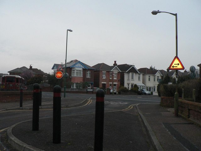
Winton: five roads? meeting place
Introduction
The photograph on this page of Winton: five roads? meeting place by Chris Downer as part of the Geograph project.
The Geograph project started in 2005 with the aim of publishing, organising and preserving representative images for every square kilometre of Great Britain, Ireland and the Isle of Man.
There are currently over 7.5m images from over 14,400 individuals and you can help contribute to the project by visiting https://www.geograph.org.uk

Image: © Chris Downer Taken: 24 Feb 2008
Here we see the end of Frederica Road, exiting onto Withermoor Road (to the sharp right) as it changes into Bengal Road (far left). Edgehill Road can be seen far right, while a sharp left turn will take us into Heathwood Road. The exact point at which Withermoor Road changes to Bengal Road might be disputed by some; it would seem more logical if it were a few yards to the north, where there is a pronounced bend at the junction with Fernside Road. Furthermore, there are no properties between the two junctions to have their house-numbering affected by this assumption.
Image Location


