Boundary Post, Belfast
Introduction
The photograph on this page of Boundary Post, Belfast by Rossographer as part of the Geograph project.
The Geograph project started in 2005 with the aim of publishing, organising and preserving representative images for every square kilometre of Great Britain, Ireland and the Isle of Man.

There are currently over 7.5m images from over 14,400 individuals and you can help contribute to the project by visiting https://www.geograph.org.uk
Boundary Post, Belfast
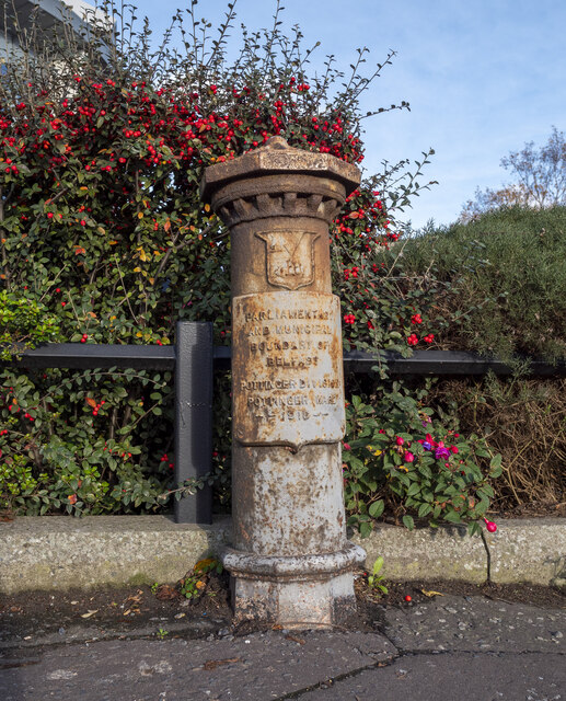
Image: © Rossographer Taken: 15 Nov 2021
Old boundary post on the Castlereagh Road, Belfast. The inscription reads: “PARLIAMENTARY AND MUNICIPAL BOUNDARY OF BELFAST POTTINGER DIVISION POTTINGER WARD 1918”. Previously seen in Image
Images are licensed for reuse under creativecommons.org/licenses/by-sa/2.0
Image Location
Latitude
54.580532
Longitude
-5.878951