Ruined buildings below the Maesgwm bridleway
Introduction
The photograph on this page of Ruined buildings below the Maesgwm bridleway by Andy Waddington as part of the Geograph project.
The Geograph project started in 2005 with the aim of publishing, organising and preserving representative images for every square kilometre of Great Britain, Ireland and the Isle of Man.

There are currently over 7.5m images from over 14,400 individuals and you can help contribute to the project by visiting https://www.geograph.org.uk
Ruined buildings below the Maesgwm bridleway
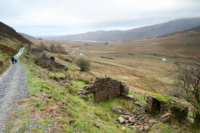
Image: © Andy Waddington Taken: 11 Nov 2021
The bridleway from Snowdon Ranger station, over Bwlch Maesgwm and on down towards Llanberis is the subject of ongoing work, presumably to "smart bridleway" standard, with traffic lights and lane closures to regulate the high speed traffic which nowadays permeates Snowdonia. Perhaps not in this weather, though the small dumper truck being driven backwards a lot faster than we can walk is just one a bevvy of works vehicles working on drains, retaining walls and compacting the surface of the track and parking areas just off it. Two National Park Warden Landrovers were also prominent in their presence a long way from anything resembling a public road - maybe it was the only place they could find to park for free. The ruined buildings don't seem to be being converted into part of the Llanberis urban sprawl (yet).
Images are licensed for reuse under creativecommons.org/licenses/by-sa/2.0
Image Location


Leaflet Map data © OpenStreetMap
Latitude
53.098928
Longitude
-4.125878