
Track at Ty-Newydd-Foel
Introduction
The photograph on this page of Track at Ty-Newydd-Foel by Andy Waddington as part of the Geograph project.
The Geograph project started in 2005 with the aim of publishing, organising and preserving representative images for every square kilometre of Great Britain, Ireland and the Isle of Man.

There are currently over 7.5m images from over 14,400 individuals and you can help contribute to the project by visiting https://www.geograph.org.uk
Track at Ty-Newydd-Foel
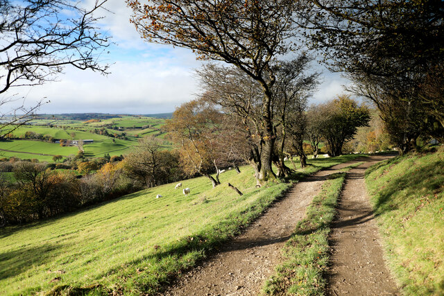
Image: © Andy Waddington Taken: 9 Nov 2021
The public footpath from Plâs-bychan climbs steadily round the southwest flanks of Moel Unben utilising this track, which has just passed Ty-Newydd-Foel (behind the hawthorns at the right hand edge of the photo) and at this point is about 300m short of meeting the (very quiet) public road again. The valley below is that of Nant Melai, a right-bank tributary of the Afon Elwy, which it joins a short distance upstream of Llanfair Talhaiarn.
Images are licensed for reuse under creativecommons.org/licenses/by-sa/2.0
Image Location

Latitude
53.194037
Longitude
-3.637326