Old Boundary Marker on Grove Street, Deptford
Introduction
The photograph on this page of Old Boundary Marker on Grove Street, Deptford by J Dunford as part of the Geograph project.
The Geograph project started in 2005 with the aim of publishing, organising and preserving representative images for every square kilometre of Great Britain, Ireland and the Isle of Man.

There are currently over 7.5m images from over 14,400 individuals and you can help contribute to the project by visiting https://www.geograph.org.uk
Old Boundary Marker on Grove Street, Deptford
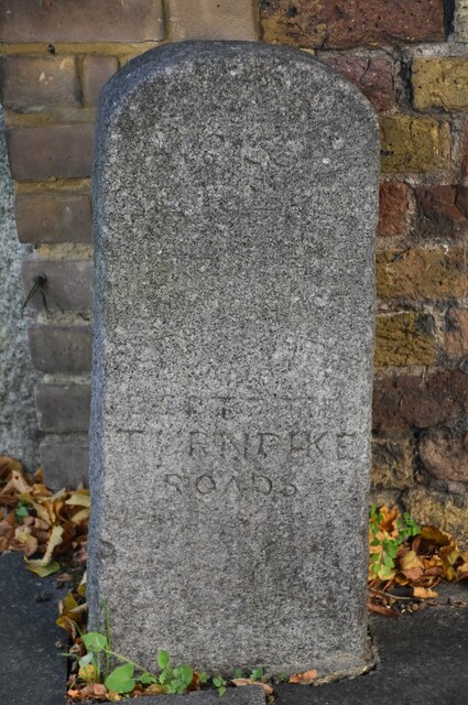
Image: © J Dunford Taken: 8 Nov 2021
Turnpike Terminus Marker against the brick wall of 1-8 The Colonnade on the east side of the B206 Grove Street, Deptford SE8. Inscribed 1855 THIS LAND IS PART OF THE BERMONDSEY ROTHERHITHE AND DEPTFORD TURNPIKE ROADS Milestone Society National ID: KE_BSt
Images are licensed for reuse under creativecommons.org/licenses/by-sa/2.0
Image Location
Latitude
51.490533
Longitude
-0.034063