Far Gosford Street
Introduction
The photograph on this page of Far Gosford Street by Ian Capper as part of the Geograph project.
The Geograph project started in 2005 with the aim of publishing, organising and preserving representative images for every square kilometre of Great Britain, Ireland and the Isle of Man.

There are currently over 7.5m images from over 14,400 individuals and you can help contribute to the project by visiting https://www.geograph.org.uk
Far Gosford Street
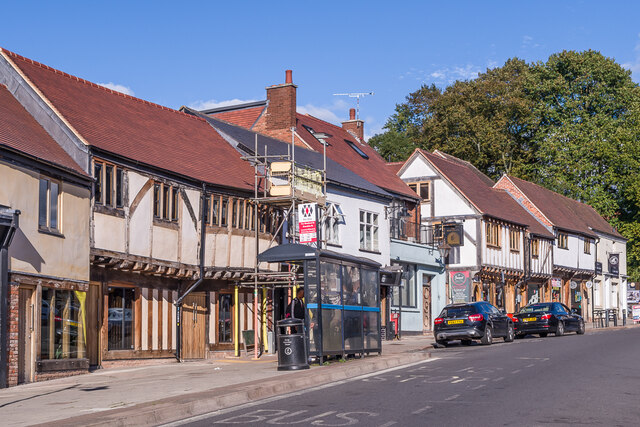
Image: © Ian Capper Taken: 24 Sep 2021
Restored buildings of various ages in Far Gosford Street, one of the historic routes into the city, now bypassed by Sky Blue Way. On the left is nos 32-33 and further along are nos 38 and nos 39-40, all 16th Century or earlier and grade II listed - see www.historicengland.org.uk/listing/the-list/list-entry/1342928, www.historicengland.org.uk/listing/the-list/list-entry/1115599 and www.historicengland.org.uk/listing/the-list/list-entry/1076644 respectively. In the centre is the former Beer Engine pub, now converted to residential use.
Images are licensed for reuse under creativecommons.org/licenses/by-sa/2.0
Image Location
Latitude
52.407736
Longitude
-1.496699