A Dutch motor-barge at Kensal Town
Introduction
The photograph on this page of A Dutch motor-barge at Kensal Town by Stefan Czapski as part of the Geograph project.
The Geograph project started in 2005 with the aim of publishing, organising and preserving representative images for every square kilometre of Great Britain, Ireland and the Isle of Man.

There are currently over 7.5m images from over 14,400 individuals and you can help contribute to the project by visiting https://www.geograph.org.uk
A Dutch motor-barge at Kensal Town
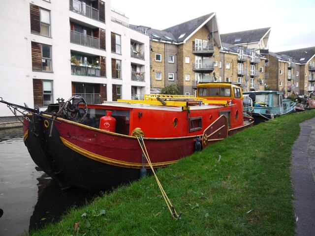
Image: © Stefan Czapski Taken: 5 Nov 2021
Moored by the Grand Union Canal (Paddington arm). I identify it as a barge because it has lee-boards, and as Dutch because - well, it looks like a Dutch barge, albeit a small one. Lee-boards are the pivoted structures which - on a flat-bottomed barge - serve instead of a keel, and render the vessel steerable. The port lee-board can be seen in the picture - painted dark red with details picked out in yellow. There's a closer view here: https://www.geograph.org.uk/photo/7011496 No name, either fore or aft, so I'd guess that it's used as a house-boat.
Images are licensed for reuse under creativecommons.org/licenses/by-sa/2.0
Image Location
Latitude
51.525802
Longitude
-0.206315