The Court
Introduction
The photograph on this page of The Court by Philip Halling as part of the Geograph project.
The Geograph project started in 2005 with the aim of publishing, organising and preserving representative images for every square kilometre of Great Britain, Ireland and the Isle of Man.

There are currently over 7.5m images from over 14,400 individuals and you can help contribute to the project by visiting https://www.geograph.org.uk
The Court
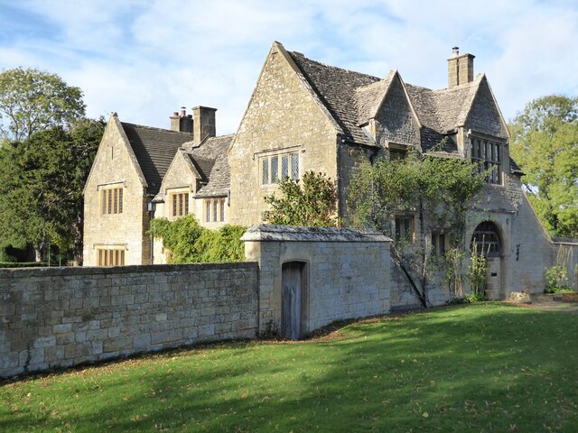
Image: © Philip Halling Taken: 1 Nov 2021
The Court was originally a gatehouse and dates from around 1600, it was restored and extended in 1898 by Guy Dawber. The house is Grade II listed, see: https://historicengland.org.uk/listing/the-list/list-entry/1287965
Images are licensed for reuse under creativecommons.org/licenses/by-sa/2.0
Image Location


Leaflet Map data © OpenStreetMap
Latitude
52.025393
Longitude
-1.860477