Brick wall, Westbourne Park Villas
Introduction
The photograph on this page of Brick wall, Westbourne Park Villas by Stefan Czapski as part of the Geograph project.
The Geograph project started in 2005 with the aim of publishing, organising and preserving representative images for every square kilometre of Great Britain, Ireland and the Isle of Man.

There are currently over 7.5m images from over 14,400 individuals and you can help contribute to the project by visiting https://www.geograph.org.uk
Brick wall, Westbourne Park Villas
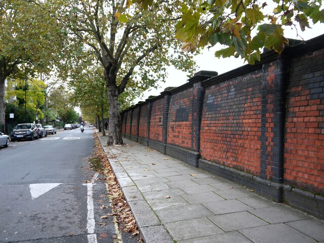
Image: © Stefan Czapski Taken: 30 Oct 2021
The south side of the street is residential, while this wall runs along the north side, separating the street system from the main rail route out of Paddington. I didn't look, but just over the wall there must be a sharp drop into the railway cutting. What grabbed my attention was the way the wall seems to lean back from the pavement - in technical terms the wall is 'battered'. While most of the brickwork is red, use has also been made of black 'engineering' brick (extra tough, typically found in railway and canal bridges). Black brick is used for the rounded corners of the uprights (piers). My first thought was that the style of building showed the influence of the Arts and Crafts movement. You can find rounded corners at the Horniman Museum, for instance. But that would date the wall to about 1900 - and the railway arrived in Paddington in 1837. If the wall dates from not long after, could it be that we're looking at a product of the mid-century craze for all things Egyptian?
Images are licensed for reuse under creativecommons.org/licenses/by-sa/2.0
Image Location
Latitude
51.518915
Longitude
-0.191163