Fundamental Benchmark
Introduction
The photograph on this page of Fundamental Benchmark by Leanmeanmo as part of the Geograph project.
The Geograph project started in 2005 with the aim of publishing, organising and preserving representative images for every square kilometre of Great Britain, Ireland and the Isle of Man.

There are currently over 7.5m images from over 14,400 individuals and you can help contribute to the project by visiting https://www.geograph.org.uk
Fundamental Benchmark
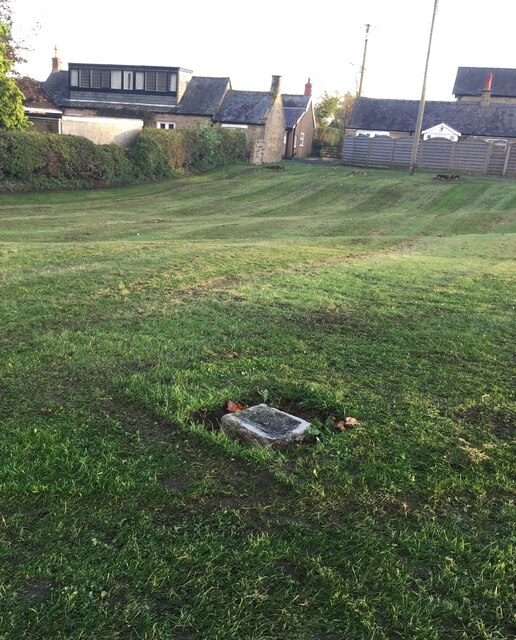
Image: © Leanmeanmo Taken: 29 Oct 2021
These Ordnance Survey benchmarks, of which there are only 200 in the UK, are the cornerstones of the countrywide height measurement network, the mean sea level reference point being the Newlyn Datum in Cornwall. Unlike the more familiar trig points, they are still in use and are regularly checked. The concrete block is set on bedrock for stability. The height is specified as 124.0106 metres. Such precision! See closeup Image For full details see https://www.bench-marks.org.uk/bm1108
Images are licensed for reuse under creativecommons.org/licenses/by-sa/2.0
Image Location
Latitude
55.24484
Longitude
-1.772385