Whitehead to Blackhead (10)
Introduction
The photograph on this page of Whitehead to Blackhead (10) by Albert Bridge as part of the Geograph project.
The Geograph project started in 2005 with the aim of publishing, organising and preserving representative images for every square kilometre of Great Britain, Ireland and the Isle of Man.

There are currently over 7.5m images from over 14,400 individuals and you can help contribute to the project by visiting https://www.geograph.org.uk
Whitehead to Blackhead (10)
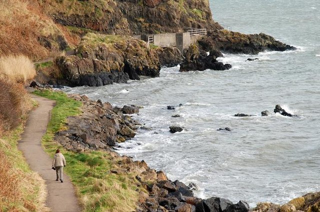
Image: © Albert Bridge Taken: 22 Feb 2008
See Image Taken from almost the same place but higher up the steps this view shows the coastal path. From here on it starts to squeeze its way between the bottom of the cliffs (typical of this part of Co Antrim) and the waters of Belfast Lough. In 1917 the 4,000 tons “Chirripo”, outbound from Belfast was sunk, just offshore, by German mines. Continue to Image
Images are licensed for reuse under creativecommons.org/licenses/by-sa/2.0
Image Location
Latitude
54.764306
Longitude
-5.693602