Old Milestone A4135, Coopers Wood
Introduction
The photograph on this page of Old Milestone A4135, Coopers Wood by Mr Red as part of the Geograph project.
The Geograph project started in 2005 with the aim of publishing, organising and preserving representative images for every square kilometre of Great Britain, Ireland and the Isle of Man.

There are currently over 7.5m images from over 14,400 individuals and you can help contribute to the project by visiting https://www.geograph.org.uk
Old Milestone A4135, Coopers Wood
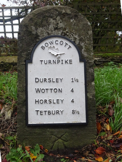
Image: © Mr Red Taken: 28 Oct 2021
Stone post by the A4135, in parish of DURSLEY (STROUD District), Coopers Wood; opposite footpath sign between house and garage on verge, by the road, on South side of road. MS erected by the Coldharbour District turnpike trust in the 19th century. The modern plate was commissioned by the house owners (behind) and installed in 2020 with advice from the Milestone Society. Cancelled BM below plate was 639.5 ft ASL. Earlier image see Image Inscription: Dursley 1½ / Wotton 4 / Horsley 4 / Tetbury 8½ Milestone Society National ID: GL_TBDY08
Images are licensed for reuse under creativecommons.org/licenses/by-sa/2.0
Image Location
Latitude
51.670379
Longitude
-2.327952