The Coombe Abbey Inn and The Hearsall Inn
Introduction
The photograph on this page of The Coombe Abbey Inn and The Hearsall Inn by Ian Capper as part of the Geograph project.
The Geograph project started in 2005 with the aim of publishing, organising and preserving representative images for every square kilometre of Great Britain, Ireland and the Isle of Man.

There are currently over 7.5m images from over 14,400 individuals and you can help contribute to the project by visiting https://www.geograph.org.uk
The Coombe Abbey Inn and The Hearsall Inn
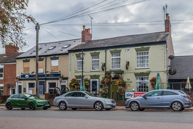
Image: © Ian Capper Taken: 24 Sep 2021
Two pubs on Craven Street. The Coombe Abbey, on the left, has a date of 1868 on its name board, although records suggest it started as a pub in 1850. It was shown on the 1888 1:500 map as the Combe (sic) Abbey Tavern. It closed around 2015 and it is proposed to be converted into apartments. The Hearsall Inn, on the right, is first recorded with a licence in 1855. It is locally listed.
Images are licensed for reuse under creativecommons.org/licenses/by-sa/2.0
Image Location
Latitude
52.407277
Longitude
-1.531617